UN
44 Lovett Way
£ 275,000
Description
We don't have a Description for this property.
- Bedrooms
- 4
- Bathrooms
- 0
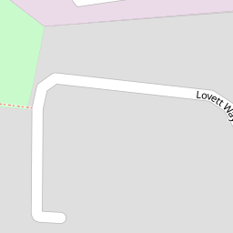
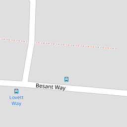

Leaflet © OpenStreetMap contributors
The heatmap indicates the level of crime in the area. The color of the heatmap indicates the crime severity and recency.
Metrics Year-on-Year
- Average area value
- 326,875.00 £Decreased by 12.86 %
- Average area rental value
- 1,658.00 £/moDecreased by 2.13 %
- Est rental Yield
- 6.09 %Increased by 12.36 %
- Crime Rate
- 2.00 %Unchanged by 0.00 %
from 375,128.00 £
from 1,694.00 £/mo
from 5.42 %
from 2.00 %
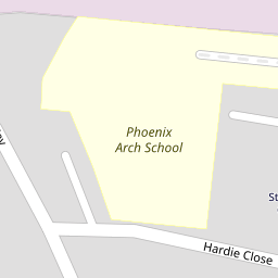
Nearby Schools
| Name | Type | Ofsted | Distance |
|---|---|---|---|
| Phoenix Arch School | Community Special School | Good | 0.20 KM |
| St Raphaels Children'S Centre | Children's Centre | 0.43 KM | |
| St Margaret Clitherow Rc Primary School | Academy Converter | 0.73 KM | |
| Oakington Manor Primary School | Academy Converter | 0.73 KM | |
| Brentfield Primary School | Community School | Good | 0.75 KM |
Images
Nearby Streets
| Name | Average Price | Average Sqft | Distance |
|---|---|---|---|
| Kestrel Close | £ 0 | 0 | 0.00 KM |
| Peregrine Close | £ 0 | 0 | 0.00 KM |
| Tallis View | £ 0 | 0 | 0.00 KM |
| Walton Drive | £ 0 | 0 | 0.00 KM |
| Chesham Street | £ 190,000 | 0 | 0.00 KM |
Nearby Transport
| Name | NLC | TLC | Distance |
|---|---|---|---|
| Stonebridge Park | 1454 | SBP | 1.60 KM |
| Harlesden | 1521 | HDN | 2.04 KM |
| Wembley Stadium | 1509 | WCX | 2.32 KM |
| Willesden Junction | 1457 | WIJ | 3.21 KM |
| Wembley Central | 1423 | WMB | 3.52 KM |
Nearby Listings
| Address | Price | Type | Score | Distance |
|---|---|---|---|---|
| Lansbury Close, Neasden | £ 500,000 | BUY | 6 / 10 | 0.21 KM |
| Bentham Walk, Neasden, London, NW10 | £ 270,000 | BUY | Unknown | 0.22 KM |
| Lewis Crescent, London, NW10 | £ 500,000 | BUY | 6 / 10 | 0.25 KM |
| Besant Way, Willesden | £ 450,000 | BUY | 4 / 10 | 0.29 KM |
| Besant Way, Willesden | £ 450,000 | BUY | Unknown | 0.29 KM |
Nearby Properties
| Address | Price | Distance |
|---|---|---|
| 55 Lovett Way | £ 385,000 | 0.00 KM |
| 82 Lovett Way | £ 208,000 | 0.00 KM |
| 73 Lovett Way | £ 352,000 | 0.00 KM |
| 44 Lovett Way | £ 275,000 | 0.00 KM |
| 60 Lovett Way | £ 315,000 | 0.00 KM |